| HM Number | HM1D0N |
|---|---|
| Tags | |
| Year Placed | 2010 |
| Placed By | City of Oakland |
| Marker Condition |           8 out of 10 (1 reports) |
| Date Added | Monday, October 6th, 2014 at 6:25am PDT -07:00 |


| UTM (WGS84 Datum) | 10S E 571024 N 4185116 |
|---|---|
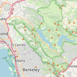
| Decimal Degrees | 37.81068333, -122.19311667 |
| Degrees and Decimal Minutes | N 37° 48.641', W 122° 11.587' |
| Degrees, Minutes and Seconds | 37° 48' 38.46" N, 122° 11' 35.22" W |
| Driving Directions | Google Maps |
| Area Code(s) | 510 |
| Closest Postal Address | At or near 3050-3098 Joaquin Miller Rd, Oakland CA 94602, US |
| Alternative Maps | Google Maps, MapQuest, Bing Maps, Yahoo Maps, MSR Maps, OpenCycleMap, MyTopo Maps, OpenStreetMap |
Is this marker missing? Are the coordinates wrong? Do you have additional information that you would like to share with us? If so, check in.
I Saw The Marker
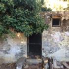
Wow, this marker is in an amazing spot. Just 1/4 mile off Highway 13 on Joaquin Miller Drive, it marks Miller's still-standing (boarded up) cottage "The Abbey" in "The Hights." Nearby are a shed used to store Miller's artifacts (with a fireplace inside); a statue of Miller on horseback; and a WPA built amphitheater with elaborate stone steps and pathways. The site is now a park owned by the city of Oakland.
Sep 28, 2017 at 9:07am PDT by chrishend
- Is this marker part of a series?
- What historical period does the marker represent?
- What historical place does the marker represent?
- What type of marker is it?
- What class is the marker?
- What style is the marker?
- Does the marker have a number?
- Can this marker be seen from the road?
- Is the marker in the median?


Comments 0 comments