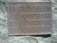
Inscription
1888 - 1903
The Foothill Station became the first University of California qualifying outlying station funded jointly by federal, state and local county sources in March 1888. The station was developed under the patronage of Senator A. Caminetti of Jackson. Over $5,000 was contributed by Amador County residents to clear the land, built irrigation systems, road, and buildings.Land was selected by E. W. Hilgard, Professor of Agriculture and Director of Experiment Stations. Four and one half miles east of Jackson, thirty-three acres were donated by the McKay Trabuccola and Oneto Families, and Senator Boggs of Colusa. By 1890 over 600 varieties of cultivated plants were established.
Wines from station-owned grapes were systematically compared with wines produced elsewhere in the state. Grain forage crops and many tree fruit and nut varieties were also studied. The Foothill Station remained open for fourteen years until November 1, 1903 when the variety evaluation work was completed.
Dedicated Saturday May 21, 1988 in recognition of 100 years of shared federal, state and local government funding of agricultural research in California.
Details
| HM Number | HM1D8P |
|---|---|
| Series | This marker is part of the Native Sons/Daughters of the Golden West series |
| Tags | |
| Year Placed | 1988 |
| Placed By | Kenneth R. Farrell, Vice President Agriculture and Natural Resources, University of California, Excelsior Parlor No.31 and Grand President Frank J. Companu, Native Sons of the Golden West |
| Marker Condition | No reports yet |
| Date Added | Sunday, September 28th, 2014 at 3:14pm PDT -07:00 |
Pictures
Photo Credits: [1] ZAMBOWEST
Locationbig map
| UTM (WGS84 Datum) | 10S E 693328 N 4248600 |
|---|---|
| Decimal Degrees | 38.36471667, -120.78713333 |
| Degrees and Decimal Minutes | N 38° 21.883', W 120° 47.228' |
| Degrees, Minutes and Seconds | 38° 21' 52.98" N, 120° 47' 13.68" W |
| Driving Directions | Google Maps |
| Area Code(s) | 209, 916 |
| Closest Postal Address | At or near 10727-10787 John C. Begovich Memorial Hwy, Jackson CA 95642, US |
| Alternative Maps | Google Maps, MapQuest, Bing Maps, Yahoo Maps, MSR Maps, OpenCycleMap, MyTopo Maps, OpenStreetMap |
Is this marker missing? Are the coordinates wrong? Do you have additional information that you would like to share with us? If so, check in.
Nearby Markersshow on map
Maintenance Issues
- What historical period does the marker represent?
- What historical place does the marker represent?
- What type of marker is it?
- What class is the marker?
- What style is the marker?
- Does the marker have a number?
- This marker could use another picture or two.
- Can this marker be seen from the road?
- Is the marker in the median?

Comments 0 comments