Star-Spangled Banner National Historic Trail
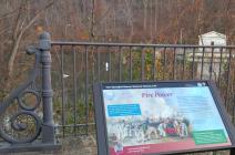
Bellona Gunpowder Company mills, operating from 1801 to 1856, was located in present-day Robert E. Lee Park along the banks of the Jones Falls. Bellona was one of several Baltimore powder mills and produced explosives used in the defense of Baltimore. At its peak it produced one-fifth of all the U.S. powder.Bellona sold 200 barrels of gunpowder to Fort McHenry in June 1814. The explosives were likely used when the British attacked that September.
(Side-bar) Homemade Powder-Gunpowder-a mixture of saltpeter, charcoal, and sulfur-fueled all explosive weapons. Escalating war and new sources of saltpeter spurred domestic production. Using powder to blast openings for mines and transportation also bolstered the industry.
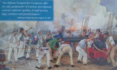
(Quote) "The Bellona Gunpowder Company offer for sale, gunpowder of various descriptions, and of a superior quality, in half barrels, kegs, canisters and pound paper."-Baltimore Federal Gazette, August 16, 1814.
(Inscription beside the photo in the center)
Gunpowder from Bellona likely fired the naval guns on the water battery at Fort McHenry during the British bombardment.
| HM Number | HM1HGV |
|---|---|
| Series | This marker is part of the Star Spangled Banner National Historic Trail series |
| Tags | |
| Historical Period | 19th Century |
| Historical Place | Business Center |
| Marker Type | Other |
| Marker Class | Historical Marker |
| Marker Style | Free Standing |
| Placed By | National Park Service-United States Department of the Interior |
| Marker Condition | No reports yet |
| Date Added | Monday, October 13th, 2014 at 8:12am PDT -07:00 |
| Location Description | Located within Robert E. Lee Park on paved trail. |
|---|---|
| UTM (WGS84 Datum) | 18S E 358436 N 4360146 |
| Decimal Degrees | 39.37920000, -76.64360000 |
| Degrees and Decimal Minutes | N 39° 22.752', W 76° 38.616' |
| Degrees, Minutes and Seconds | 39° 22' 45.1200" N, 76° 38' 36.9600" W |
| Driving Directions | Google Maps |
| Area Code(s) | 410, 443 |
| Can be seen from road? | No |
| Is marker in the median? | No |
| Closest Postal Address | At or near , Baltimore MD 21210, US |
| Alternative Maps | Google Maps, MapQuest, Bing Maps, Yahoo Maps, MSR Maps, OpenCycleMap, MyTopo Maps, OpenStreetMap |
Is this marker missing? Are the coordinates wrong? Do you have additional information that you would like to share with us? If so, check in.
- Which side of the road is the marker located?


Comments 0 comments