Inscription
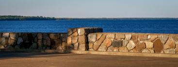
Named from the fur traders' phrase "The Thousand Lakes Region," this lake is 1250 feet above sea level and covers about 200 square miles. It formerly included much low ground and several adjacent lakes. When visited by Du Luth in 1679, Sioux villages, now indicated by numerous burial mounds, lined the lake shore.
DESIGNED AND CONSTRUCTED
BY
Minnesota Highway Department
National Park Service
Village of Garrison
Civilian Conservation Corps
Details
| HM Number | HM1HK0 |
|---|---|
| Additional Information | See MNDOT's Inventory Sheet for further info. |
| Series | This marker is part of the Minnesota Department of Highways series, and the Minnesota CCC Projects series. |
| Tags | |
| Historical Period | Pre Columbian, 19th Century, 18th Century, 17th Century |
| Historical Place | Other |
| Marker Type | Historic District |
| Marker Class | Historical Marker |
| Marker Style | Mounted |
| Marker Number | CW-GRC-001 |
| Year Placed | 1939 |
| Placed By | Minnesota Highway Dept, National Park Service, Village of Garrison, Civilian Conservation Corps |
| Marker Condition | No reports yet |
| Date Added | Thursday, October 30th, 2014 at 9:00pm PDT -07:00 |
Pictures
Photo Credits: [1] MARTHA DECKER [2] MARTHA DECKER [3] MARTHA DECKER [4] MARTHA DECKER [5] MARTHA DECKER [6] MARTHA DECKER [7] MNDOT ARCHIVES
Locationbig map
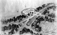
| Location Description | This marker was placed on the lake side of the Stone Flagpole Base in the Garrison Concourse Wayside in 1939. The Concourse, located in the town of Garrison, Minnesota on Lake Mille Lacs, was constructed mainly by the CCC from 1936 to 1939. There is another marker on the site that was placed in 1927, prior to the Concourse being built. |
|---|---|
| UTM (WGS84 Datum) | 15T E 436550 N 5127050 |
| Decimal Degrees | 46.29406667, -93.82380000 |
| Degrees and Decimal Minutes | N 46° 17.644', W 93° 49.428' |
| Degrees, Minutes and Seconds | 46° 17' 38.6400" N, 93° 49' 25.6800" W |
| Driving Directions | Google Maps |
| Area Code(s) | 320, 218 |
| Can be seen from road? | No |
| Is marker in the median? | No |
| Which side of the road? | Marker is on the right when traveling North |
| Closest Postal Address | At or near Concourse Road, Garrison MN 56450, US |
| Alternative Maps | Google Maps, MapQuest, Bing Maps, Yahoo Maps, MSR Maps, OpenCycleMap, MyTopo Maps, OpenStreetMap |
Is this marker missing? Are the coordinates wrong? Do you have additional information that you would like to share with us? If so, check in.
Nearby Markersshow on map
Show me all markers in: Garrison, MN | Crow Wing County | 56450 | Minnesota | United States of America
Related Markers


Comments 0 comments