Inscription
The Canalway Trail
The Erie Canal tied together western New York and became a conduit for ideas as well as for commerce. Seneca Falls was the site of the first Women's Sufferage convention, organized by Elizabeth Cady Stanton and Lucretia Mott in 1848 to advocate for woman's right to own property and vote. In Rochester and Ithaca, abolitionists were stirred by the rhetoric of Frederick Douglass and the exploits of Harriet Tubman, who aided runaway slaves' flights to freedom via the Underground Railroad. Palmyra and Port Byron were the homes of Joseph Smith and Brigham Young, who founded a new religion called Mormonism. And in the utopian communities of Oneida and Chautauqua, radical ideas about communal ownership and open marriage found ready acceptance. This period of social and spiritual reform, sometimes called the "Second Great Awakening" led to the end of slavery, universal sufferage, Prohibition, the Civil Rights movement, and a profound change in the course of American History. The Centrepoint Aqueduct. West of Weedsport are the structural remains of the Centerport Aqueduct. The towpath bridge over this aqueduct was reconstructed to be nearly identical to the one built here in 1854-55. The towpath bridge, then used by mules and horses to pull boats filled with cargo or passengers along the Erie Canal, is today used by bicyclists, walkers and others to cross the confluence of the Cold Spring Brook and North Brook. North Brook was a feeder for the original 1825 Erie Canal, also called Clinton's Ditch. The trough of the Centreport Aqueduct was sixty feet long by fifty wide, and the flooring was built of huge oak beams, sixteen inches square. Atop this lay bottom planking of four inch thick pine. The entire wooden structure was cradled below the elevated towpath (image on the right) by masonry that supported the enormous weight of both trough and water,Details
| HM Number | HM1KPP |
|---|---|
| Series | This marker is part of the Erie Canal series |
| Tags | |
| Placed By | New York State Canals |
| Marker Condition | No reports yet |
| Date Added | Sunday, May 24th, 2015 at 6:01pm PDT -07:00 |
Pictures
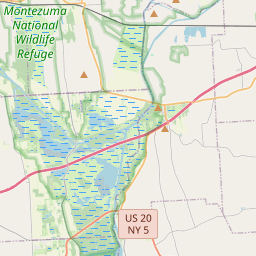
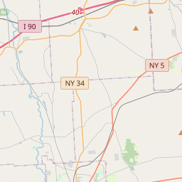
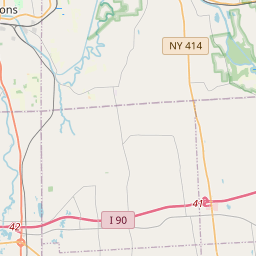
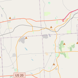
Locationbig map

| UTM (WGS84 Datum) | 18T E 371627 N 4766800 |
|---|---|
| Decimal Degrees | 43.04305000, -76.57605000 |
| Degrees and Decimal Minutes | N 43° 2.583', W 76° 34.563' |
| Degrees, Minutes and Seconds | 43° 2' 34.98" N, 76° 34' 33.78" W |
| Driving Directions | Google Maps |
| Area Code(s) | 315 |
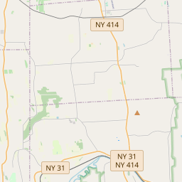
| Closest Postal Address | At or near 2490 State Hwy 31, Weedsport NY 13166, US |
| Alternative Maps | Google Maps, MapQuest, Bing Maps, Yahoo Maps, MSR Maps, OpenCycleMap, MyTopo Maps, OpenStreetMap |
Is this marker missing? Are the coordinates wrong? Do you have additional information that you would like to share with us? If so, check in.
Maintenance Issues
- What historical period does the marker represent?
- What historical place does the marker represent?
- What type of marker is it?
- What class is the marker?
- What style is the marker?
- Does the marker have a number?
- What year was the marker erected?
- This marker needs at least one picture.
- Can this marker be seen from the road?
- Is the marker in the median?
Comments 0 comments