Inscription
The Historic National Road in Ohio
The Broad Street bridge is a significant part of the history of Columbus and the National Road. Until 1816, the only ways to cross the Scioto River were to ford the river during low water or to use the ferry. From 1816 to 1834 a series of wooden toll bridges were built to span the river. In 1834, the National Road Bridge was constructed. This covered bridge was free of any tolls and remained in service until replaced by an iron truss bridge in 1883. The flood of 1913 heavily damaged that bridge.In conjunction with the 1908 Master Plan for redevelopment of the city, a new bridge would be built to withstand future floods. Design and construction of the bridge started during World War I, The Federal government promoted the use of concrete instead of structural steel in local civic projects, since steel was needed for the war effort. Built in a Renaissance Revival style with seven arch spans, the bridge could carry four lanes of automobile traffic and two trolley lines. Despite three floods during construction, the cost of the bridge actually came in under the original estimates.
Completed in 1921, the bridge was named in honor of veterans of World War I. In 1927, a plaque commemorating the National Road was placed on the bridge.
In 1990, the seven span, earth filled, barrel-vaulted bridge was removed, and work began on the
present five span plate-arch structure.
Original commemorative plaques and a section of the limestone balustrade railing from the 1921 structure are located in a memorial park at the west end of the bridge.
Details
| HM Number | HM1TG5 |
|---|---|
| Series | This marker is part of the The Historic National Road series |
| Tags | |
| Year Placed | 2013 |
| Placed By | The Hadler and Peppe Families, Dean C. Ringle, P.E,, P.S., Franklin County Engineer |
| Marker Condition | No reports yet |
| Date Added | Tuesday, August 2nd, 2016 at 9:01am PDT -07:00 |
Pictures
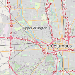
Locationbig map


| UTM (WGS84 Datum) | 17S E 328645 N 4425396 |
|---|---|
| Decimal Degrees | 39.96136667, -83.00623333 |
| Degrees and Decimal Minutes | N 39° 57.682', W 83° 0.374' |
| Degrees, Minutes and Seconds | 39° 57' 40.92" N, 83° 0' 22.44" W |
| Driving Directions | Google Maps |
| Area Code(s) | 614, 513 |
| Which side of the road? | Marker is on the right when traveling East |
| Closest Postal Address | At or near Lower Scioto Greenway, Columbus OH 43215, US |
| Alternative Maps | Google Maps, MapQuest, Bing Maps, Yahoo Maps, MSR Maps, OpenCycleMap, MyTopo Maps, OpenStreetMap |
Is this marker missing? Are the coordinates wrong? Do you have additional information that you would like to share with us? If so, check in.
Nearby Markersshow on map
Maintenance Issues
- What historical period does the marker represent?
- What historical place does the marker represent?
- What type of marker is it?
- What class is the marker?
- What style is the marker?
- Does the marker have a number?
- This marker needs at least one picture.
- Can this marker be seen from the road?
- Is the marker in the median?
Comments 0 comments