Inscription
Samuel K. Barlow (1792-1867)
an Oregon Pioneer from Kentucky
Wamic — Miles 32
Dalles California Highway — Miles 38
Maupin — Miles 48
Details
| HM Number | HM24F6 |
|---|---|
| Tags | |
| Placed By | Mt. Hood National Forest, U.S. Forest Service |
| Marker Condition | No reports yet |
| Date Added | Sunday, January 7th, 2018 at 4:02pm PST -08:00 |
Pictures
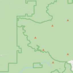
Locationbig map


| UTM (WGS84 Datum) | 10T E 603146 N 5015207 |
|---|---|
| Decimal Degrees | 45.28280000, -121.68480000 |
| Degrees and Decimal Minutes | N 45° 16.968', W 121° 41.088' |
| Degrees, Minutes and Seconds | 45° 16' 58.08" N, 121° 41' 5.2800000000001" W |
| Driving Directions | Google Maps |
| Area Code(s) | 503 |
| Which side of the road? | Marker is on the right when traveling East |
| Closest Postal Address | At or near NF-3530, Government Camp OR 97028, US |
| Alternative Maps | Google Maps, MapQuest, Bing Maps, Yahoo Maps, MSR Maps, OpenCycleMap, MyTopo Maps, OpenStreetMap |
Is this marker missing? Are the coordinates wrong? Do you have additional information that you would like to share with us? If so, check in.
Nearby Markersshow on map
Maintenance Issues
- Is this marker part of a series?
- What historical period does the marker represent?
- What historical place does the marker represent?
- What type of marker is it?
- What class is the marker?
- What style is the marker?
- Does the marker have a number?
- What year was the marker erected?
- This marker needs at least one picture.
- Can this marker be seen from the road?
- Is the marker in the median?
Comments 0 comments