Inscription
There is abundant evidence of Indian occupation on Peebles and Van Schaick Islands. Hammerstones and projectile points have been discovered and suggest that early tribes lived in this area. Archeologists uncovered a number of early hearths here that may be evidence of drying fish for winter use.
The first Europeans known to have visited Peebles Island came by a small boat from Henry Hudson's ship Half Moon in 1609. Later in the 17th century, the Dutch planted crops along the island's northern floodplain and grazed their cattle in other areas. By the 1670s, the Dutch called Peebles Island Haver, or Oat, Island, a name retained until 1862.
[Image captions, from top to bottom and left to right, read]
· Village Image
· This 1630 map shows Peebles Island as the location of Menomine's Castle, a village named for an important Mohican leader.
· These Indian flint arrow points were discovered on Peebles Island by archeologists.
· On September 22, 1609, five of Henry Hudson's men left the Half Moon, which was anchored south of Albany, to explore farther up the Hudson River. They were probably the first Europeans to visit Peebles Island.
· Hoppe Eyland (Hop Island), which appears on this 1656 map of New Netherland, may be an early Dutch name for Peebles Island,
shown near Kahoos (today Cohoes). Goosen Gerritsen van Schaick, who acquired the island in 1664, was a brewer and may have grown hops here as early as the 1650s.
· This June 1677 deed between Annatje van Schaick and Jan Jacobson van Noorstandt, which conveys "two margens (4,232 acres) of arable land lying on Hoever Island," contains the first written appearance of the island's name.
Details
| HM Number | HM2681 |
|---|---|
| Tags | |
| Placed By | New York State Parks, Recreation and Historic Preservation |
| Marker Condition | No reports yet |
| Date Added | Saturday, March 24th, 2018 at 7:03pm PDT -07:00 |
Pictures
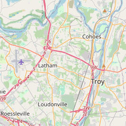
Locationbig map


| UTM (WGS84 Datum) | 18T E 607940 N 4737788 |
|---|---|
| Decimal Degrees | 42.78503333, -73.68031667 |
| Degrees and Decimal Minutes | N 42° 47.102', W 73° 40.819' |
| Degrees, Minutes and Seconds | 42° 47' 6.1199999999998" N, 73° 40' 49.14" W |
| Driving Directions | Google Maps |
| Area Code(s) | 518 |
| Which side of the road? | Marker is on the right when traveling South |
| Closest Postal Address | At or near 300 Delaware Ave, Cohoes NY 12047, US |
| Alternative Maps | Google Maps, MapQuest, Bing Maps, Yahoo Maps, MSR Maps, OpenCycleMap, MyTopo Maps, OpenStreetMap |
Is this marker missing? Are the coordinates wrong? Do you have additional information that you would like to share with us? If so, check in.
Nearby Markersshow on map
Maintenance Issues
- Is this marker part of a series?
- What historical period does the marker represent?
- What historical place does the marker represent?
- What type of marker is it?
- What class is the marker?
- What style is the marker?
- Does the marker have a number?
- What year was the marker erected?
- This marker needs at least one picture.
- Can this marker be seen from the road?
- Is the marker in the median?
Comments 0 comments