Inscription
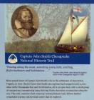
Captain John Smith Chesapeake National Historic Trail
"Passing along the coast, searching every inlet, and bay, fit for harbours and habitations..."
Captain Johns Smith, describing his explorations of the Chesapeake region in 1608.
Many people know of Captain John Smith's role in the settlement of Jamestown, Virginia, in 1607. But few know that Smith also explored and mapped nearly 3,000 miles of the Chesapeake Bay and its tributaries, all in an open boat, with a small group of companions, encountering many thriving Native American communities along the way. This trail, America's first waterway national historic trail, follow's Smith's remarkable journey and the tidal waters that he explored.
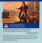
Star-Spangled Banner National Historic Trail
"And the star-spangled banner in triumph shall wave
O'er the land of the free and the home of the brave."
Francis Scott Key, fourth stanza of the Star Spangled Banner, 1814.
The 290-mile historic trail connects the places and events of the War of 1812 that led Francis Scott Key to pen the words to our national anthem. A major part of that history—the route of the invading British fleet in late summer of 1814—is found here in Southern Maryland.
Religious Freedom National Scenic Byway
No Person or Persons...shall henceforth be in any ways troubled molested or discountenanced for or in respect of his or her Religion nor in the free exercise thereof..."
Act Concerning Religion
Maryland General Assembly, April 21, 1649
Freedom of religion in America has its roots here in Southern Maryland. Along this scenic byway you can explore the story behind the first attempt in America to introduce what were considered radical ideas: religious toleration and to separate church from government. This fundamental belief can be traced through American history to the First Amendment of the Constitution guaranteeing everyone living the United States the right to believe as they wish.
Potomac Heritage
National Scenic Trail
"...a great avenue into the Western Country...one of the finest rivers in the world..."
George Washington, describing
The Potomac River in 1793
George Washington lived along and traveled the Potomac River, pursuing his dream to connect the Atlantic Seaboard with an expanding western frontier. His efforts to use the river as a commercial artery influenced industrialization and development in the 1800s and beyond. From tidewater here in Southern Maryland to the Youghiogheny River in western Pennsylvania, this trail network connects the sites and terrain that shaped our first president's life, and thus shaped a young America.
Discover more at
www.DestinationSouthernMaryland.com
National Park Service
U.S. Department of the Interior
This project was funded in part by the National Park Service
This project has been financed in part with state funds from the Maryland Heritages Areas Authority, an instrumentality of the State of Maryland. However, the contents and opinions do not necessarily reflect views or policies of the Maryland Heritage Areas Authority.
Details
| HM Number | HM29MR |
|---|---|
| Tags | |
| Historical Period | 18th Century, 17th Century |
| Historical Place | Plantation, Park, National Register of Historic Places, Gov Building |
| Marker Type | Historic District |
| Marker Class | Historical Marker |
| Marker Style | Interpretative Marker / Sign |
| Year Placed | 2018 |
| Placed By | The National Park Service, the Southern Maryland Heritage Area Consortium, and the Maryland Heritage Areas Authority. |
| Marker Condition | No reports yet |
| Date Added | Sunday, July 22nd, 2018 at 3:30am PDT -07:00 |
Pictures
Photo Credits: [1] NATIONAL PARK SERVICE, THOMAS STONE NATIONAL HISTORIC SITE [2] NATIONAL PARK SERVICE, THOMAS STONE NATIONAL HISTORIC SITE [3] NATIONAL PARK SERVICE, THOMAS STONE NATIONAL HISTORIC SITE [4] NATIONAL PARK SERVICE, THOMAS STONE NATIONAL HISTORIC SITE [5] NATIONAL PARK SERVICE, THOMAS STONE NATIONAL HISTORIC SITE [6] NATIONAL PARK SERVICE, THOMAS STONE NATIONAL HISTORIC SITE
Locationbig map
| Directions Information | Enter Thomas Stone National Historic Site. Turn left at the T-intersection. Stop in Visitor Center parking lot. |
|---|---|
| Location Description | Marker is located to the right of the doors to the Visitor Center. |
| UTM (WGS84 Datum) | 18S E 322542 N 4266618 |
| Decimal Degrees | 38.53028333, -77.03586667 |
| Degrees and Decimal Minutes | N 38° 31.817', W 77° 2.152' |
| Degrees, Minutes and Seconds | 38° 31' 49.02" N, 77° 2' 9.12" W |
| Driving Directions | Google Maps |
| Area Code(s) | 301, 240 |
| Can be seen from road? | No |
| Is marker in the median? | No |
| Which side of the road? | Marker is on the right when traveling North |
| Closest Postal Address | At or near 6370 Crain Hwy, La Plata MD 20646, US |
| Alternative Maps | Google Maps, MapQuest, Bing Maps, Yahoo Maps, MSR Maps, OpenCycleMap, MyTopo Maps, OpenStreetMap |
Is this marker missing? Are the coordinates wrong? Do you have additional information that you would like to share with us? If so, check in.
Nearby Markersshow on map
Discover Thomas Stone National Historic Site
Discover Thomas Stone National Historic Site
Ways to Explore Southern Maryland's Scenic and Historic Routes
Ways to Explore Southern Maryland's Scenic and Historic Routes
Discover Southern Maryland's Amazing Stories of Exploration, Hope, and Courage
Welcome to Haberdeventure!
Thomas Stone
Rose Hill
Rose Hill
Port Tobacco
Maintenance Issues
- Is this marker part of a series?


Comments 0 comments