Inscription
Homestake Mining District
—Lead, South Dakota —
Battery locomotives were the work horse of locomotives used in the Homestake Mine. Every operating level had at least one locomotive and up to 4 or 5 locomotives. These locomotives hauled ore trains, miners to the work area, mechanics and electricians to problem areas and literally tons of supplies and explosives used in the mine.The battery locomotive was powered by the huge bank of batteries that was the largest component of the locomotives. These batteries held a charge for the duration of the working shift, usually 8 hours. Then, the batteries had to be recharged by plugging them into the charging station, usually near the shaft.
The locomotive operator had to step on a "deadman" switch, located on the floor of the cab, which allowed activation of the locomotive. The "deadman" switch prevented inadvertent operation of the locomotive without an operator.
This small battery locomotive on display was used in the upper levels of the Homestake Mine and, due to its small size, probably was used as a tramming locomotive, too small for ore trains. These trammers were also used on the surface throughout the shop and service areas.
Details
| HM Number | HM2AD8 |
|---|---|
| Tags | |
| Placed By | Black Hills Mining Museum |
| Marker Condition | No reports yet |
| Date Added | Tuesday, August 14th, 2018 at 1:05pm PDT -07:00 |
Pictures
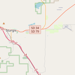
Locationbig map

| UTM (WGS84 Datum) | 13T E 598244 N 4911693 |
|---|---|
| Decimal Degrees | 44.35186667, -103.76730000 |
| Degrees and Decimal Minutes | N 44° 21.112', W 103° 46.038' |
| Degrees, Minutes and Seconds | 44° 21' 6.7199999999999" N, 103° 46' 2.2799999999998" W |
| Driving Directions | Google Maps |
| Area Code(s) | 605 |
| Which side of the road? | Marker is on the right when traveling East |
| Closest Postal Address | At or near 323 W Main St, Lead SD 57754, US |
| Alternative Maps | Google Maps, MapQuest, Bing Maps, Yahoo Maps, MSR Maps, OpenCycleMap, MyTopo Maps, OpenStreetMap |
Is this marker missing? Are the coordinates wrong? Do you have additional information that you would like to share with us? If so, check in.
Nearby Markersshow on map
Show me all markers in: Lead, SD | Lawrence County | 57754 | South Dakota | United States of America
Maintenance Issues
- Is this marker part of a series?
- What historical period does the marker represent?
- What historical place does the marker represent?
- What type of marker is it?
- What class is the marker?
- What style is the marker?
- Does the marker have a number?
- What year was the marker erected?
- This marker needs at least one picture.
- Can this marker be seen from the road?
- Is the marker in the median?
Comments 0 comments