Inscription
Honoring the B&O railroad's premier architect
One of many handsome structures designed by B&O architect E. Francis Baldwin, the station was built in 1884 along the Old Main Line. The building contained a ticket and telegraph office, separate waiting rooms for men and women, and a freight room. Upstairs were five small rooms for the stationmaster and his family.In 1949 passenger service was discontinued here. In the 1990s the building was donated to the Town of Sykesville. Original colors were restored and deteriorated wood elements replaced. Later a kitchen was added to refit the station for commercial use as a restaurant.
[Captions:]
From 1872-1900, Ephraim Francis Baldwin (1837-1916) served as the chief architect for the B&O Railroad. Baldwin also designed churches, schools, seminaries, and hospitals. Of more than 500 structures he designed, most were located in and around Baltimore. Many are still standing.
Baldwin's much-photographed 1875 Victorian-style station at Point of Rocks, MD, exemplifies the architect's distinctive style.
Baldwin designed this station's chimneys to resemble the smokestack of an old steam locomotive.
Note the stained glass, multiple gables, arched window recesses, and decorative brick and wood elements on this Queen Anne-style treasure.
Details
| HM Number | HM2GW9 |
|---|---|
| Tags | |
| Placed By | Maryland Heritage Area Authority, Maryland Main Street, Sykesville Main Street |
| Marker Condition | No reports yet |
| Date Added | Sunday, May 19th, 2019 at 8:02am PDT -07:00 |
Pictures
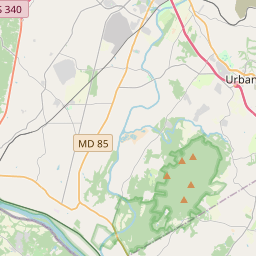
Locationbig map


| UTM (WGS84 Datum) | 18S E 330367 N 4359055 |
|---|---|
| Decimal Degrees | 39.36431667, -76.96905000 |
| Degrees and Decimal Minutes | N 39° 21.859', W 76° 58.143' |
| Degrees, Minutes and Seconds | 39° 21' 51.54" N, 76° 58' 8.58" W |
| Driving Directions | Google Maps |
| Which side of the road? | Marker is on the right when traveling South |
| Closest Postal Address | At or near , , |
| Alternative Maps | Google Maps, MapQuest, Bing Maps, Yahoo Maps, MSR Maps, OpenCycleMap, MyTopo Maps, OpenStreetMap |
Is this marker missing? Are the coordinates wrong? Do you have additional information that you would like to share with us? If so, check in.
Nearby Markersshow on map
Maintenance Issues
- What country is the marker located in?
- Is this marker part of a series?
- What historical period does the marker represent?
- What historical place does the marker represent?
- What type of marker is it?
- What class is the marker?
- What style is the marker?
- Does the marker have a number?
- What year was the marker erected?
- This marker needs at least one picture.
- Can this marker be seen from the road?
- Is the marker in the median?
Comments 0 comments