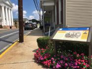
Inscription
Enemies and Friends
— Antietam Campaign 1862 —
When Gen. Robert E. Lee and part of the Army of Northern Virginia passes through Middletown on September 10-11, 1862, they encountered a chilly reception. The inhabitants of this single-street hamlet on the National Road loved the Union, and the ragged Confederates who marched west through here epitomized what the citizens regarded as a rebellion. Confronted by openly defiant residents, the Confederates considered Middletown the most Union of all places they saw during their first trek to Maryland. When part of Gen. George B. McClellan's Army of the Potomac marched through town a few days later, the citizens were more welcoming.Following the Battle of South Mountain on September 14, Middletown's churches and dwellings became hospitals for Union casualties. Future President of the United States Rutherford B. Hayes, then a lieutenant colonel of the 23rd Ohio Infantry, was wounded at Fox's Gap. His wife, Lucy, nursed him back to health at Jacob Rudy's home at 504 West Main Street.
Insert Top Left: After Confederate Gen. Robert E. Lee's smashing victory over Union Gen. John Pope at the Second Battle of Manassas, Lee decided to invade Maryland to reap the fall harvest, gain Confederate recruits, earn foreign recognition of the Confederacy and perhaps compel the Union to sue for peace. The Army of Northern Virginia crossed the Potomac River on September 4, 1862. Lee divided his forces, detaching Gen. Thomas J. "Stonewall" Jackson's corps to capture Harper's Ferry. At Antietam Creek on September 17, Gen. George B. McClellan's Army of the Potomac fought Lee's men to a bloody draw. Lee retreated to Virginia September 18-19.
Picture Insert: As Gen. Thomas J. "Stonewall" Jackson rode through Middletown on September 10, two very pretty girls with ribbons of red, white, and blue in their hair and small Union flags in their hands ran out to the curbstone, and laughingly waved their colors defiantly in the face of the General. He bowed and lifted his cap with a quiet smile and said to his staff, "We evidently have no friends in this town." -Henry Kyd Douglas, I Rode with Stonewall
Details
| HM Number | HMEH0 |
|---|---|
| Series | This marker is part of the Maryland Civil War Trails series |
| Tags | |
| Historical Period | 19th Century |
| Historical Place | Town |
| Marker Type | Historic District |
| Marker Class | Historical Marker |
| Marker Style | Free Standing |
| Placed By | Maryland Civil War Trails |
| Marker Condition | No reports yet |
| Date Added | Friday, September 5th, 2014 at 2:18pm PDT -07:00 |
Pictures
Locationbig map
| UTM (WGS84 Datum) | 18S E 280736 N 4369129 |
|---|---|
| Decimal Degrees | 39.44383333, -77.54798333 |
| Degrees and Decimal Minutes | N 39° 26.63', W 77° 32.879' |
| Degrees, Minutes and Seconds | 39° 26' 37.8000" N, 77° 32' 52.7400" W |
| Driving Directions | Google Maps |
| Area Code(s) | 301, 240 |
| Can be seen from road? | Yes |
| Is marker in the median? | No |
| Which side of the road? | Marker is on the right when traveling East |
| Closest Postal Address | At or near 200 W Main St, Middletown MD 21769, US |
| Alternative Maps | Google Maps, MapQuest, Bing Maps, Yahoo Maps, MSR Maps, OpenCycleMap, MyTopo Maps, OpenStreetMap |
Is this marker missing? Are the coordinates wrong? Do you have additional information that you would like to share with us? If so, check in.
Nearby Markersshow on map


Comments 0 comments