Inscription
Highlights of Lover's Leap State Park
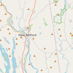
New Milford, CT
Lover's Leap State Park is located in southern New Milford. The Housatonic River flows through the park and forms the headwaters of Lake Lillinonah. This historic 140 acre park began in 1971 when Catherine Hurd bequeathed her 52 acre estate to the State of Connecticut for use as a ?public park.' In 2001, the Connecticut Light & Power Company sold 86 adjoining acres to the Connecticut Department of Environmental Protection, with the intention of expanding the park and preserving its unique character.
A thriving community of Native Americans occupied this strategic site for over 8,000 years. Its location and elevation allowed for observation and signaling over great distances. The fertile fields of the river valley, abundance of game and migration of salmon, shad, ell, and other anadromous fish from Long Island Sound up to the "Great Falls" assured a reliable food source. The Great Falls blocked the passage of shad from migrating further up river. Since the construction of the Shepaug Dam and creation of Lake Lillinonah, the falls are now 14 feet below the surface of the Housatonic.
The park contains a breathtaking river gorge, made famous by the Indian legend of Chief Waramaug's beautiful daughter, Princess Lillinonah. She canoed to her death into the "Great Falls" when her white lover did not return after visiting his people. Upon his return, he saw her in the rapids and leaped to his death in an attempt to save her.
The last Native Americans to occupy the site were the Weantinocks, lead by the Great Sachem Waramaug. They lived in harmony with the white settlers in the area. Chief Waramaug died in 1735, and is believed he is buried near the river gorge.
The ruins of the Bridgeport Wood Finishing Company, (1882 to 1927) whose grinding wheels were once powered by the mighty Housatonic River, are also located within the park. It is one of only 16 of Connecticut's "State Archaeological Preserves" and is also listed on the State Register of Historic Places as an early manufacturing site.
A trail system honeycombs the 140 acres; an old railroad abutment provides the perfect fishing spot and nearby is a kayak/canoe rest area. At the Lake Lillinonah side of the park is a kayak/canoe portage.
"Falls Bridge" spans Lover's Leap gorge and is one of the many highlights of the park. Built by the Berlin Iron Bridge Company in 1895, it was recently refurbished with $1.9 million dollars (80% Federal and 20% New Milford funding). This graceful structure is the crown jewel of the park and epitomizes the era of iron bridge building. As one of only four iron lenticular truss bridges remaining in Connecticut, it was placed on the National Register of Historic Places in 1976. It is the linchpin in the park trail system and a magnificent sight to behold.
In 2004, Friends of Lover's Leap State Park, a non-profit organization was formed for the betterment of the park. Since then, a 40 car parking lot was constructed with generously donated volunteer labor, equipment and materials. Interpretive signage is located throughout the park thanks to a generous donation from the Ellen Knowles Harcourt Foundation. Numerous volunteers and volunteer organizations have contributed their time and talents toward the establishment of what is now the newest and one of the most beautiful State Parks in Connecticut.
We thank the Department of Environmental Protection, Parks Division, for their assistance and cooperation and all those who have helped to proudly bring this ?dream' to reality.
"We hope you enjoy, respect and help preserve Lover's Leap State Park for future generations".
Hon. Jeanne W. Garvey, Chairman
Friends of Lover's Leap State Park
June 16, 2007
Details
| HM Number | HMF16 |
|---|---|
| Tags | |
| Year Placed | 2007 |
| Placed By | Friends of Lover's Leap State Park |
| Marker Condition | No reports yet |
| Date Added | Tuesday, September 16th, 2014 at 12:55pm PDT -07:00 |
Pictures
Locationbig map

| UTM (WGS84 Datum) | 18T E 632812 N 4600356 |
|---|---|
| Decimal Degrees | 41.54385000, -73.40766667 |
| Degrees and Decimal Minutes | N 41° 32.631', W 73° 24.46' |
| Degrees, Minutes and Seconds | 41° 32' 37.86" N, 73° 24' 27.60" W |
| Driving Directions | Google Maps |
| Area Code(s) | 860, 203 |
| Closest Postal Address | At or near 51 Pumpkin Hill Rd, New Milford CT 06776, US |
| Alternative Maps | Google Maps, MapQuest, Bing Maps, Yahoo Maps, MSR Maps, OpenCycleMap, MyTopo Maps, OpenStreetMap |
Is this marker missing? Are the coordinates wrong? Do you have additional information that you would like to share with us? If so, check in.
Nearby Markersshow on map
Show me all markers in: New Milford, CT | Litchfield County | 06776 | Connecticut | United States of America
Maintenance Issues
- Is this marker part of a series?
- What historical period does the marker represent?
- What historical place does the marker represent?
- What type of marker is it?
- What class is the marker?
- What style is the marker?
- Does the marker have a number?
- This marker needs at least one picture.
- Can this marker be seen from the road?
- Is the marker in the median?
Comments 0 comments