Inscription
On June 30, 1863, the quiet little town of Hanover suddenly exploded in gunfire and bloodshed. The Battle of Hanover, fought between Confederate Cavalry led by Major General J.E.B. Stuart and Brigadier General Judson Kilpatrick's Union Cavalry, lasted most of the day. Local doctors rushed to treat fallen soldiers where they lay on narrow streets and sidewalks. After the fighting ended, citizens carted the wounded to makeshift hospitals, including one in a concert hall and the other in a small armory.
The federal government opened an army hospital in a private school building on Baltimore Road a few days later. One hundred and fifty wounded soldiers from the fights at Hanover and Gettysburg recuperated in Hanover. Thousands more passed through the community on their way home or to other infirmaries. Local women served as nurses and aides, and the army surgeon in charge, Dr. P. Gardner, reported, "Every desired comfort is furnished in great abundance, and every luxury, with which this county abounds in great profusion, is supplied by sympathetic people, and administered to the suffering wounded by devoted women. A heartier response to the calls of humanity never came from a more generous people than we have witnessed here."
The federal government opened an army hospital in a private school building on Baltimore Road a few days later. One hundred and fifty wounded soldiers from the fights at Hanover and Gettysburg recuperated in Hanover. Thousands more passed through the community on their way home or to other infirmaries. Local women served as nurses and aides, and the army surgeon in charge, Dr. P. Gardner, reported, "Every desired comfort is furnished in great abundance, and every luxury, with which this county abounds in great profusion, is supplied by sympathetic people, and administered to the suffering wounded by devoted women. A heartier response to the calls of humanity never came from a more generous people than we have witnessed here."
Details
| HM Number | HMF1F |
|---|---|
| Series | This marker is part of the Pennsylvania: Pennsylvania Civil War Trails series |
| Tags | |
| Year Placed | 2009 |
| Placed By | Pennsylvania Department of Community and Economic Development, www.VisitPA.com |
| Marker Condition | No reports yet |
| Date Added | Wednesday, September 17th, 2014 at 7:27am PDT -07:00 |
Pictures
Locationbig map


| UTM (WGS84 Datum) | 18S E 330552 N 4407031 |
|---|---|
| Decimal Degrees | 39.79638333, -76.97916667 |
| Degrees and Decimal Minutes | N 39° 47.783', W 76° 58.75' |
| Degrees, Minutes and Seconds | 39° 47' 46.98" N, 76° 58' 45.00" W |
| Driving Directions | Google Maps |
| Area Code(s) | 717 |
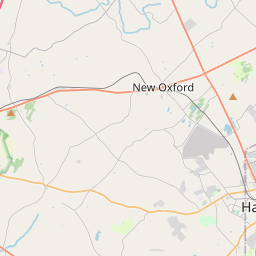
| Closest Postal Address | At or near 305 Baltimore St, Hanover PA 17331, US |
| Alternative Maps | Google Maps, MapQuest, Bing Maps, Yahoo Maps, MSR Maps, OpenCycleMap, MyTopo Maps, OpenStreetMap |
Is this marker missing? Are the coordinates wrong? Do you have additional information that you would like to share with us? If so, check in.
Nearby Markersshow on map
Maintenance Issues
- What historical period does the marker represent?
- What historical place does the marker represent?
- What type of marker is it?
- What class is the marker?
- What style is the marker?
- Does the marker have a number?
- This marker needs at least one picture.
- Can this marker be seen from the road?
- Is the marker in the median?
Comments 0 comments