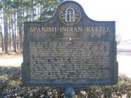
Inscription
(1702)
Early in 1702 Joseph de Zu?iga, Spanish Governor of Florida, and Pierre le Moyne Iberville, French founder of Louisiana, made plans to check steadily increasing English trade with the Indian tribes in the interior, and perhaps to drive them out of the Southeast. To accomplish this, they agreed to an expedition against the English and their allies, the Creek Indians, in the Carolina territory which is now Georgia.In August, Governor Zu?iga sent a force northward of more than 800 Spaniards and Apalaches commanded by Captain Francisco Romo de Uriza. Forewarned by the Indians, Anthony Dodsworth and other traders at Coweta (near present Columbus), marshalled about 500 Creek warriors, lured the invaders into an ambush on the Flint River near here and routed them.
An outstanding authority on Southern frontier history, Dr. Verner W. Crane, said that this battle, "?the prelude to Queen Anne's War on the Southern frontier," was in effect "the first blow struck by the English for the control of the Mississippi Valley."
Details
| HM Number | HMF53 |
|---|---|
| Series | This marker is part of the Georgia: Georgia Historical Society/Commission series |
| Tags | |
| Marker Number | 040-9 |
| Year Placed | 1965 |
| Placed By | Georgia Historical Commission |
| Marker Condition | No reports yet |
| Date Added | Monday, September 15th, 2014 at 8:50pm PDT -07:00 |
Pictures
Locationbig map
| UTM (WGS84 Datum) | 17R E 224868 N 3539770 |
|---|---|
| Decimal Degrees | 31.96060000, -83.91101667 |
| Degrees and Decimal Minutes | N 31° 57.636', W 83° 54.661' |
| Degrees, Minutes and Seconds | 31° 57' 38.16" N, 83° 54' 39.66" W |
| Driving Directions | Google Maps |
| Area Code(s) | 229 |
| Closest Postal Address | At or near 4626 Unnamed Road, Cordele GA 31015, US |
| Alternative Maps | Google Maps, MapQuest, Bing Maps, Yahoo Maps, MSR Maps, OpenCycleMap, MyTopo Maps, OpenStreetMap |
Is this marker missing? Are the coordinates wrong? Do you have additional information that you would like to share with us? If so, check in.
Nearby Markersshow on map
Maintenance Issues
- What historical period does the marker represent?
- What historical place does the marker represent?
- What type of marker is it?
- What class is the marker?
- What style is the marker?
- This marker could use another picture or two.
- Can this marker be seen from the road?
- Is the marker in the median?

Comments 0 comments