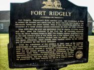
Inscription
FORT RIDGELY
Fort Ridgely both contradicts and fits the popular culture stereotype of a frontier fort. Following its 1855 completion, the Fort's primary role was to assist the federal government with an orderly transition of land ownership from American Indians to the growing number of European immigrant farmers. Nothing in that definition suggests the need for a stockade for defense against dramatic attacks.
Yet that is what happened. When the six-week U.S.-Dakota War began in August, 1862, the fort assumed great importance as the only military post in the area. On August 20 and 22, 1862, as many as 400 Dakota warriors attacked the fort, defended by just 280 soldiers and refugees. The use of artillery compensated for the lack of a stockade and for the fort's vulnerable location, compelling Dakota forces to withdraw.
Up until the events that led to war in 1862, loneliness and boredom afflicted the Fort Ridgely soldiers: records described complaints about housekeeping detail and harsh winters. With the outbreak of the Civil War in 1861, Minnesota's citizen soldiers relieved regular Army soldiers needed in the South. When the U.S.-Dakota War of 1862 erupted, those same volunteer soldiers were among the first to respond and the first to fall in combat. Hundreds of European immigrant families fled to Fort Ridgely for protection.
The U.S. military abandoned the fort in 1872, and most of the buildings deteriorated or were converted for other uses. The state erected a battle monument in 1896. In 1911, the Minnesota Legislature created Fort Ridgely State Park. Excavations in 1935 revealed eight building foundations. The fort's stone commissary was preserved and today serves as a visitor center.
Clean Water, Land & Legacy Amendment
Minnesota Historical Society
Details
| HM Number | HM1BUP |
|---|---|
| Series | This marker is part of the Minnesota Historical Society series |
| Tags | |
| Historical Period | 20th Century, 19th Century |
| Historical Place | Park, Military Installation, Fort, Battlefield |
| Marker Type | Historic District |
| Marker Class | Historical Marker |
| Marker Style | Free Standing |
| Year Placed | 2012 |
| Placed By | Minnesota Historical Society |
| Marker Condition | No reports yet |
| Date Added | Sunday, September 21st, 2014 at 12:03pm PDT -07:00 |
Pictures
Photo Credits: [1] MARTHA DECKER [2] MARTHA DECKER
Locationbig map
| UTM (WGS84 Datum) | 15T E 361953 N 4923693 |
|---|---|
| Decimal Degrees | 44.45336667, -94.73510000 |
| Degrees and Decimal Minutes | N 44° 27.202', W 94° 44.106' |
| Degrees, Minutes and Seconds | 44° 27' 12.1200" N, 94° 44' 6.3600" W |
| Driving Directions | Google Maps |
| Area Code(s) | 507 |
| Can be seen from road? | Yes |
| Is marker in the median? | No |
| Which side of the road? | Marker is on the right when traveling West |
| Closest Postal Address | At or near 72404 Co Rd 30, Fairfax MN 55332, US |
| Alternative Maps | Google Maps, MapQuest, Bing Maps, Yahoo Maps, MSR Maps, OpenCycleMap, MyTopo Maps, OpenStreetMap |
Is this marker missing? Are the coordinates wrong? Do you have additional information that you would like to share with us? If so, check in.
Nearby Markersshow on map
Show me all markers in: Fairfax, MN | Nicollet County | 55332 | Minnesota | United States of America
Maintenance Issues
- This marker could use another picture or two.


Comments 0 comments