Inscription
[Front of Marker:]Dedicated April 23, 2000 by James Stretesky Benicia Historical Society Benicia (N.S.G.W.) Native Sons Richard & Veronica Tipton Benicia Camel Barn Museum Exxon Mobile, Benicia Refinery Benicia Chamber of Commerce Benicia Volunteer Fire Department Pony Express Trail Association [A list of sponsors is on bottom of base]
[Back of marker:]
Captain Oliver C. Coffin and his brothers purchased the ferry "Carquinez" from an eastern shipyard. The double end dual paddle wheel ferry modeled after the New York-Brooklyn ferry boats of that period. It was shipped around Cape Horn as ballast in a sailing ship and put in use by the Coffins in 1854.
An 1860 schedule shows that this ferry operated every 30 minutes between Benicia and Martinez. The first trip of each day left at 8:00 a.m. from Martinez to Benicia.
On April 23, 1860, the ferry was alerted by telegraph from Sacramento to be in Benicia early. The ferry was needed to carry the Pony Express mail across the Strait. The ferry docked here at the foot of First Street and Pony Express rider Thomas Bedford was on board the ferry at 7:05 a.m.
2000 Joe Nardone
[A list of donors is on bottom of base]
Details
| HM Number | HMANI |
|---|---|
| Series | This marker is part of the More Than Words series, and the Pony Express National Historic Trail series. |
| Tags | |
| Marker Condition | No reports yet |
| Date Added | Saturday, October 25th, 2014 at 7:31am PDT -07:00 |
Pictures
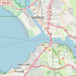
Locationbig map


| UTM (WGS84 Datum) | 10S E 573473 N 4211081 |
|---|---|
| Decimal Degrees | 38.04448333, -122.16265000 |
| Degrees and Decimal Minutes | N 38° 2.669', W 122° 9.759' |
| Degrees, Minutes and Seconds | 38° 2' 40.14" N, 122° 9' 45.54" W |
| Driving Directions | Google Maps |
| Area Code(s) | 707, 858, 415, 510, 925 |
| Closest Postal Address | At or near 90 1st St, Benicia CA 94510, US |
| Alternative Maps | Google Maps, MapQuest, Bing Maps, Yahoo Maps, MSR Maps, OpenCycleMap, MyTopo Maps, OpenStreetMap |
Is this marker missing? Are the coordinates wrong? Do you have additional information that you would like to share with us? If so, check in.
Nearby Markersshow on map
Maintenance Issues
- What historical period does the marker represent?
- What historical place does the marker represent?
- What type of marker is it?
- What class is the marker?
- What style is the marker?
- Does the marker have a number?
- What year was the marker erected?
- Who or what organization placed the marker?
- This marker needs at least one picture.
- Can this marker be seen from the road?
- Is the marker in the median?

Comments 0 comments