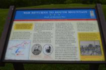
Inscription
Battle of Monterey Pass
— Gettysburg Campaign —
(Preface):After a stunning victory at Chancellorsville in May 1863, Confederate Gen. Robert E. Lee led the Army of Northern Virginia through Maryland into Pennsylvania, marching next to threaten Philadelphia, Baltimore, and Washington, D.C. The Army of the Potomac marched north from the capital, searching for Lee. On July 1-3, the armies collided at Gettysburg in one of the pivotal battles of the Civil War. The Confederates retraced their steps to Virginia after a bloody defeat.During the Battle of Gettysburg, detachments of Gen. Robert E. Lee's army occupied key roads and gaps in South Mountain behind the Confederate line. Monterey Pass, just north of here was one of those vital gaps. On the night of July 3, defeated at Gettysburg, Lee ordered his supply and ambulance trains through the gaps to clear the roads for the army's retreat.
The next night, probing between the Confederate army and South Mountain, Union Gen. H. Judson Kilpatrick's cavalry division caught up with the Confederate wagon train and its defenders at Monterey Pass. He attacked Capt. George H. Emack's Co. B, 1st Maryland Battalion, which Gen. William E. "Grumble" Jones had reinforced with two cavalry regiments and an artillery battery. In pitch dark and pouring rain, a chaotic, vicious fight began around 9 P.M., illuminated by cannon fire, small-arms fire, and lightning bolts. It raged for more than five hours until Kilpatrick's force broke through the defenders and headed in this direction while the Confederates continued their retreat.
Kilpatrick ordered the 1st Vermont Cavalry to pursue the wagon trains to your left along the western base of South Mountain in the valley below. Local resident C.H. Burman guided the regiment through Raven Rock Pass to Smithsburg (to your left). After capturing several wagons at Leitersburg, the Vermonters rejoined Kilpatrick at Ringgold and rode south to Smithsburg. Soon the division was in another fight, this time with part of Confederate Gen. J.E.B. Stuart's cavalry corps.
(Sidebar): The Confederate ambulances, supply wagons, artillery caravans, and herds of cattle, sheep, and hogs stretched for more than 50 miles along Pennsylvania's roads. Adding to the misery of the thousands of wounded men who moaned or screamed at every jolt of the wagons, the heavens opened and rain turned the dirt roads to muddy soup.
Details
| HM Number | HMKRN |
|---|---|
| Series | This marker is part of the Maryland Civil War Trails series |
| Tags | |
| Historical Period | 19th Century |
| Historical Place | Battlefield |
| Marker Type | Other |
| Marker Class | Historical Marker |
| Marker Style | Interpretative Marker / Sign |
| Placed By | Maryland Civil War Trails |
| Marker Condition | No reports yet |
| Date Added | Thursday, October 23rd, 2014 at 6:40am PDT -07:00 |
Pictures
Photo Credits: [1] DOUGLAS MOWEN
Locationbig map
| Location Description | Marker is in the Pen Mar Park. Near the lookout over the Cumberland Valley |
|---|---|
| UTM (WGS84 Datum) | 18S E 284925 N 4399363 |
| Decimal Degrees | 39.71705000, -77.50915000 |
| Degrees and Decimal Minutes | N 39° 43.023', W 77° 30.549' |
| Degrees, Minutes and Seconds | 39° 43' 1.3800" N, 77° 30' 32.9400" W |
| Driving Directions | Google Maps |
| Can be seen from road? | No |
| Is marker in the median? | No |
| Which side of the road? | Marker is on the right when traveling South |
| Closest Postal Address | At or near Appalachian Trail, Highfield-Cascade MD , US |
| Alternative Maps | Google Maps, MapQuest, Bing Maps, Yahoo Maps, MSR Maps, OpenCycleMap, MyTopo Maps, OpenStreetMap |
Is this marker missing? Are the coordinates wrong? Do you have additional information that you would like to share with us? If so, check in.
Nearby Markersshow on map
Show me all markers in: Highfield-Cascade, MD | Washington County | Maryland | United States of America
Maintenance Issues
- This marker could use another picture or two.
- Area Code

Comments 0 comments