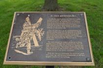
Inscription
On this day, June 6, in the year 1944 allied forces invaded Normandy - the most massive invasion attempt in history. By nightfall, they had liberated 80 miles of French soil and a toehold for the consequential drive into Germany was established. Although the invasion was a success, it was not without supreme sacrifice. Over 10,000 casualties were suffered on this historic day.
Now, 40 years later, we are commemorating this historic turning point with the planting of a tree at Fort Richie. It is a fitting place as many of the members of the 29th Infantry Division trained here before the division was activated and sent to Europe where they were among the first to land at Normandy.
The tree selected for today's ceremony is fitting because of its strength and independence. The soil used contains amounts of soil from the beaches and cliffs of Normandy. This further symbolizes the fact that the success of the invasion was a joining of the Armed Forces of two great continents.
With this tree as a memorial, the sacrifices made forty years ago will be long remembered. It will be a tangible symbol of our heritage.
Details
| HM Number | HMKS3 |
|---|---|
| Tags | |
| Historical Period | 20th Century |
| Historical Place | Memorial |
| Marker Type | Memorial |
| Marker Class | War Memorial |
| Marker Style | Free Standing |
| Year Placed | 1994 |
| Marker Condition | No reports yet |
| Date Added | Tuesday, September 2nd, 2014 at 1:05am PDT -07:00 |
Pictures
Photo Credits: [1] DOUGLAS MOWEN
Locationbig map
| UTM (WGS84 Datum) | 18S E 286243 N 4398223 |
|---|---|
| Decimal Degrees | 39.70711667, -77.49341667 |
| Degrees and Decimal Minutes | N 39° 42.427', W 77° 29.605' |
| Degrees, Minutes and Seconds | 39° 42' 25.6200" N, 77° 29' 36.3000" W |
| Driving Directions | Google Maps |
| Area Code(s) | 301, 240 |
| Can be seen from road? | Yes |
| Is marker in the median? | No |
| Which side of the road? | Marker is on the right when traveling South |
| Closest Postal Address | At or near Castle Dr, Highfield-Cascade MD 21719, US |
| Alternative Maps | Google Maps, MapQuest, Bing Maps, Yahoo Maps, MSR Maps, OpenCycleMap, MyTopo Maps, OpenStreetMap |
Is this marker missing? Are the coordinates wrong? Do you have additional information that you would like to share with us? If so, check in.
Nearby Markersshow on map
Show me all markers in: Highfield-Cascade, MD | Washington County | 21719 | Maryland | United States of America
Maintenance Issues
- Is this marker part of a series?
- Who or what organization placed the marker?
- This marker could use another picture or two.

Comments 0 comments