Inscription
THE SKYLINE PARKWAY
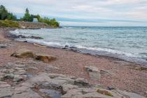
As you face Lake Superior, you will find that the eastern access to the Skyline Parkway, a 30-mile drive along the rim of the hills overlooking Duluth and Lake Superior, begins here to your right on the left bank of the Lester River. As you proceed north along the river you cross it to your left at Superior Street and then take the first road to your right. You are now on the Seven Bridges Road which follows the Amity Creek. Crossing it seven times before reaching the shoreline of pre-historic Glacial Lake Duluth and the Skyline Parkway, 560 feet above the present level of Lake Superior.
The Amity Creek and Lester River pursue indirect courses through lava formations of the Keweenawan age. The creek beds, while picturesque are relatively recent geologic age compared to the Gabbro outcroppings to the west and north. The prevailing soil is red clay deposited when the waters of Glacial Lake Duluth receded 600 million years ago. Seven Bridges Road, popular with painters and photographers, presents some of Duluth's most frequently reproduced scenes and is a recreation area for both winter and summer sports.
One of a series of Skyline Drive Commemorative Plaques erected in 1972 by the Duluth Lions Club in cooperation with the Duluth Area Chamber of Commerce Convention & Visitors Bureau.
Details
| HM Number | HMTYL |
|---|---|
| Additional Information | In 2016, the marker was in relatively good condition. It was readable but missing a few letters that appear to have been purposely removed by vandals. |
| Series | This marker is part of the Duluth, Minnesota Skyline Drive Commemorative Plaques series |
| Tags | |
| Historical Period | 19th Century, 20th Century, Pre Columbian |
| Historical Place | Town, Residential Community, Park, Other, Bridge |
| Marker Type | Historic District |
| Marker Class | Historical Marker |
| Marker Style | Mounted |
| Year Placed | 1972 |
| Placed By | Duluth Lions Club, Duluth Area Chamber of Commerce Convention & Visitors Bureau |
| Marker Condition | No reports yet |
| Date Added | Thursday, October 23rd, 2014 at 9:07pm PDT -07:00 |
Pictures
Photo Credits: [1] MARTHA DECKER [2] MARTHA DECKER [3] MARTHA DECKER [4] MARTHA DECKER
Locationbig map
| Location Description | This marker is located at a pullout on Lake Superior's shoreline at Brighton Beach. It is very near the mouth of the Lester River at the northeast end of Duluth on Minn Hwy 61. |
|---|---|
| UTM (WGS84 Datum) | 15T E 575875 N 5187509 |
| Decimal Degrees | 46.83680000, -92.00500000 |
| Degrees and Decimal Minutes | N 46° 50.208', W 92° 0.3' |
| Degrees, Minutes and Seconds | 46° 50' 12.4800" N, 92° 0' 18.0000" W |
| Driving Directions | Google Maps |
| Area Code(s) | 218 |
| Can be seen from road? | Yes |
| Is marker in the median? | No |
| Which side of the road? | Marker is on the right when traveling East |
| Closest Postal Address | At or near 6090 Congdon Blvd, Duluth MN 55804, US |
| Alternative Maps | Google Maps, MapQuest, Bing Maps, Yahoo Maps, MSR Maps, OpenCycleMap, MyTopo Maps, OpenStreetMap |
Is this marker missing? Are the coordinates wrong? Do you have additional information that you would like to share with us? If so, check in.
Nearby Markersshow on map
Show me all markers in: Duluth, MN | St. Louis County | 55804 | Minnesota | United States of America
Related Markers


Comments 0 comments